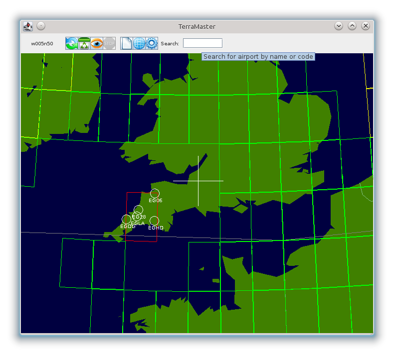
GUI for managing FlightGear scenery collections
- Visualize your FlightGear scenery collections on a world map.
- Add and update scenery tiles from the FlightGear scenery server.
- Remove unwanted scenery tiles.
TerraMaster lets you do all this using a simple point-and-click interface.
It's written in Java so it'll work on Windows, Mac, Linux, etc.
Licence
This program is free software; you can redistribute it and/or modify it under the terms of the GNU General Public License version 2 as published by the Free Software Foundation.
Acknowledgements
Keith Paterson contributed bugfixes and resource-loading code so that the entire program runs from a self-contained JAR file.
This software makes use of
- The SVNKit library from TMate Software http://svnkit.com
- The Java Map Projection Library http://www.jhlabs.com/java/maps/proj/
- JarClassLoader from JDotSoft http://jdotsoft.com/JarClassLoader.php
- Free icons from Aha-Soft http://www.small-icons.com/packs/24x24-free-application-icons.htm
- The Global Self-consistent, Hierarchical, High-resolution Geography Database (GSHHG) https://www.ngdc.noaa.gov/mgg/shorelines/gshhs.html
- FlightGear multiplayer map server for airport & navaid lookup http://mpmap02.flightgear.org
